Autonomous Navigation
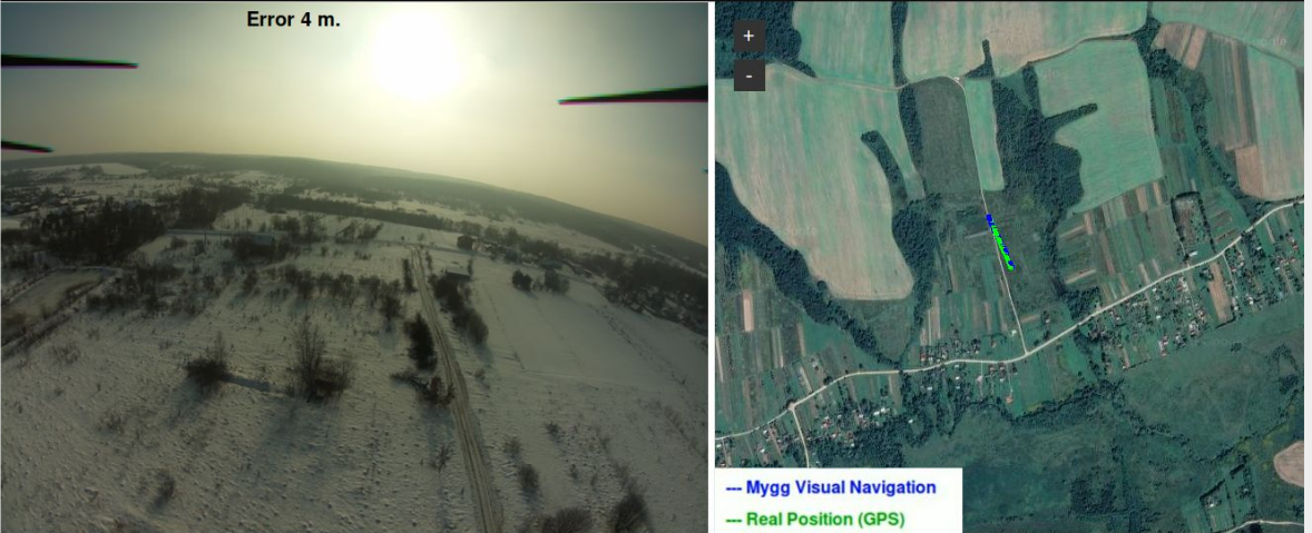
The Mygg Visual Navigation System is a software library intended to be used by drone manufacturers and drone software developers to provide their drone with autonomous navigation immune to electronic warfare.
The software is intended to be run on an on-board computer on the drone. The system analyses images from the existing camera on the drone and compares them with on-board satellite images to determine its position, without using GPS.
The system works in environments that have been heavily altered by seasonal effects like snow or that have suffered major destruction. Currently, we support flights at altitudes of 20 meters and upwards.
In normal environments, you can expect a position accuracy of less than 10 meters.